iPhoneAlle anzeigen
iPhone 11iPhone 11 ProiPhone 11 Pro MaxiPhone 12iPhone 12 ProiPhone 12 Pro MaxiPhone 12 miniiPhone 13iPhone 13 ProiPhone 13 Pro MaxiPhone 13 miniiPhone 14iPhone 14 PlusiPhone 14 ProiPhone 14 Pro MaxiPhone 15iPhone 15 PlusiPhone 15 ProiPhone 15 Pro MaxiPhone 16iPhone 16 PlusiPhone 16 ProiPhone 16 Pro MaxiPhone 16eiPhone 8iPhone 8 PlusiPhone SE 2020iPhone SE 2022iPhone XiPhone XRiPhone XSiPhone XS Max
Galaxy A-SerieAlle anzeigen
Galaxy A12Galaxy A13Galaxy A13 5GGalaxy A14Galaxy A15Galaxy A16Galaxy A17 5GGalaxy A20eGalaxy A21Galaxy A22Galaxy A23Galaxy A24Galaxy A25Galaxy A26 5GGalaxy A32Galaxy A33Galaxy A34Galaxy A35Galaxy A36 5GGalaxy A40Galaxy A41Galaxy A42Galaxy A50Galaxy A51Galaxy A52Galaxy A53Galaxy A54Galaxy A55Galaxy A56 5GGalaxy A70Galaxy A71Galaxy A72
Redmi SeriesAlle anzeigen
Redmi 10Redmi 13CRedmi 15 5GRedmi Note 10Redmi Note 10 ProRedmi Note 11Redmi Note 11 ProRedmi Note 11 Pro Plus 5GRedmi Note 11sRedmi Note 12Redmi Note 12 5GRedmi Note 12 ProRedmi Note 12 Pro 5GRedmi Note 12 Pro PlusRedmi Note 13Redmi Note 13 5GRedmi Note 13 ProRedmi Note 13 Pro PlusRedmi Note 14Redmi Note 14 Pro PlusRedmi Note 8Redmi Note 8 ProRedmi Note 9Redmi Note 9 Pro
- Startseite
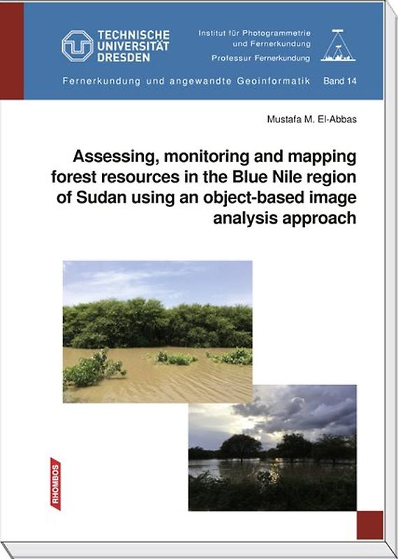
Bücher Englische Bücher Wissen & Bildung Naturwissenschaft, Medizin, Informatik, Technik Geowissenschaft Stadt-, Raum- und Landschaftsplanung Assessing, monitoring and mapping forest resources in the Blue Nile region of Sudan using an object-based imageanalysis approach
Derzeit nicht verfügbar
Handgeprüfte Gebrauchtware
Bis zu 50 % günstiger als neu
Der Umwelt zuliebe
Assessing, monitoring and mapping forest resources in the Blue Nile region of Sudan using an object-based imageanalysis approach
Mustafa Mahmoud El-Abbas (Taschenbuch, Englisch)
★★★★★
☆☆☆☆☆ Keine Bewertungen vorhanden
Optischer Zustand
Beschreibung
Following the hierarchical nature of forest resource management, the present work focuses on the natural forest cover at various abstraction levels of details, i.e. categorical land use/land cover (LU/LC) level and a continuous empirical estimation of local operational level. As no single sensor presently covers absolutely all the requirements of the entire levels of forest resource assessment,… multisource imagery (i.e. RapidEye, TERRA ASTER and LANDSAT TM), in addition to other data and knowledge have been examined. To deal with this structure, an object-based image analysis (OBIA) approach has been assessed in the destabilized Blue Nile region of Sudan as a potential solution to gather the required information for future forest planning and decision making. Moreover, the spatial heterogeneity as well as the rapid changes observed in the region motivates the inspection for more efficient, flexible and accurate methods to up-date the desired information.
An OBIA approach has been proposed as an alternative analysis framework that can mitigate the deficiency associated with the pixel-based approach. In this sense, the study examines the most popular pixel-based maximum likelihood classifier, as an example of the behavior of spectral classifier toward respective data and regional specifics. In contrast, the OBIA approach analyzes remotely sensed data by incorporat-ing expert analyst knowledge and complimentary ancillary data in a way that somehow simulates human intelligence for image interpretation based on the real-world representation of the features. As the segment is the basic processing unit, various combinations of segmentation criteria were tested to separate similar spectral values into groups of relatively homogeneous pixels. At the categorical subtraction level, rules were developed and optimum features were extracted for each particular class. Two methods were allocated (i.e. Rule Based (RB) and Nearest Neighbour (NN) Classifier) to assign segmented objects to their corresponding classes.
Moreover, the study attempts to answer the questions whether OBIA is inherently more precise at fine spatial resolution than at coarser resolution, and how both pixel-based and OBIA approaches can be compared regarding relative accuracy in function of spatial resolution. As anticipated, this work emphasizes that the OBIA approach is can be proposed as an advanced solution particulary for high resolution imagery, since the accuracies were improved at the different scales applied compare with those of pixel-based approach. Meanwhile, the results achieved by the two approaches are consistently high at a finer RapidEye spatial resolution, and much significantly enhanced with OBIA.
Since the change in LU/LC is rapid and the region is heterogeneous as well as the data vary regarding the date of acquisition and data source, this motivated the implementation of post-classification change detection rather than radiometric transformation methods. Based on thematic LU/LC maps, series of optimized algorithms have been developed to depict the dynamics in LU/LC entities. Therefore, detailed change “from-to” information classes as well as changes statistics were produced. Furthermore, the produced change maps were assessed, which reveals that the accuracy of the change maps is consistently high.
Aggregated to the community-level, social survey of household data provides a comprehensive perspective addi-tionally to EO data. The predetermined hot spots of degraded and successfully recovered areas were investigated. Thus, the study utilized a well-designed questionnaire to address the factors affecting land-cover dynamics and the possible solutions based on local community's perception.
At the operational structural forest stand level, the rationale for incorporating these analyses are to offer a semi-automatic OBIA metrics estimates from which forest attrib-ute is acquired through automated segmentation algorithms at the level of delineated tree crowns or clusters of crowns. Correlation and regression analyses were applied to identify the relations between a wide range of spectral and textural metrics and the field derived forest attributes. The acquired results from the OBIA framework reveal strong relationships and precise estimates. Furthermore, the best fitted models were cross-validated with an independent set of field samples, which revealed a high degree of precision. An important question is how the spatial resolution and spectral range used af-fect the quality of the developed model this was also discussed based on the different sensors examined.
To conclude, the study reveals that the OBIA has proven capability as an efficient and accurate approach for gaining knowledge about the land features, whether at the operational forest structural attributes or categorical LU/LC level. Moreover, the methodological framework exhibits a potential solution to attain precise facts and figures about the change dynamics and its driving forces. Dieses Produkt haben wir gerade leider nicht auf Lager.
Handgeprüfte Gebrauchtware
Bis zu 50 % günstiger als neu
Der Umwelt zuliebe
Technische Daten
Erscheinungsdatum
01.01.2019
Sprache
Englisch
EAN
9783937231716
Herausgeber
Rhombos-Verlag
Sonderedition
Nein
Autor
Mustafa Mahmoud El-Abbas
Seitenanzahl
226
Auflage
Volume 14 of the series "Remote Sensing and Applied Geoinformatics"
Einbandart
Taschenbuch
Einbandart Details
Klebebindung
Schlagwörter
TERRA ASTER, land use, forest, Waldressourcenmanagement, RapidEye, image analysis, LANDSAT TM
Thema-Inhalt
RBP - Meteorologie und Klimatologie (Klimaforschung)
RGW - Geographische Informationssysteme (GIS) und Fernerkundung
RGL - Regionale Geographie
RBK - Hydrologie und die Hydrosphäre
RGB - Physische Geographie und Topographie
Höhe
176 mm
Breite
25 cm
-.-
★★★★★
☆☆☆☆☆ Leider noch keine Bewertungen
Leider noch keine Bewertungen
Sicher bei rebuy kaufen

Schreib die erste Bewertung für dieses Produkt!
Wenn du eine Bewertung für dieses Produkt schreibst, hilfst du allen Kund:innen, die noch überlegen, ob sie das Produkt kaufen wollen. Vielen Dank, dass du mitmachst!
Sicher bei rebuy kaufen