iPhoneAlle anzeigen
iPhone 11iPhone 11 ProiPhone 11 Pro MaxiPhone 12iPhone 12 ProiPhone 12 Pro MaxiPhone 12 miniiPhone 13iPhone 13 ProiPhone 13 Pro MaxiPhone 13 miniiPhone 14iPhone 14 PlusiPhone 14 ProiPhone 14 Pro MaxiPhone 15iPhone 15 PlusiPhone 15 ProiPhone 15 Pro MaxiPhone 16iPhone 16 PlusiPhone 16 ProiPhone 16 Pro MaxiPhone 16eiPhone 8iPhone 8 PlusiPhone SE 2020iPhone SE 2022iPhone XiPhone XRiPhone XSiPhone XS Max
Galaxy A-SerieAlle anzeigen
Galaxy A12Galaxy A13Galaxy A13 5GGalaxy A14Galaxy A15Galaxy A16Galaxy A17 5GGalaxy A20eGalaxy A21Galaxy A22Galaxy A23Galaxy A24Galaxy A25Galaxy A26 5GGalaxy A32Galaxy A33Galaxy A34Galaxy A35Galaxy A36 5GGalaxy A40Galaxy A41Galaxy A42Galaxy A50Galaxy A51Galaxy A52Galaxy A53Galaxy A54Galaxy A55Galaxy A56 5GGalaxy A70Galaxy A71Galaxy A72
Redmi SeriesAlle anzeigen
Redmi 10Redmi 13CRedmi 15 5GRedmi Note 10Redmi Note 10 ProRedmi Note 11Redmi Note 11 ProRedmi Note 11 Pro Plus 5GRedmi Note 11sRedmi Note 12Redmi Note 12 5GRedmi Note 12 ProRedmi Note 12 Pro 5GRedmi Note 12 Pro PlusRedmi Note 13Redmi Note 13 5GRedmi Note 13 ProRedmi Note 13 Pro PlusRedmi Note 14Redmi Note 14 Pro PlusRedmi Note 8Redmi Note 8 ProRedmi Note 9Redmi Note 9 Pro
- Startseite
Bücher Englische Bücher Wissen & Bildung Naturwissenschaft, Medizin, Informatik, Technik Geowissenschaft Stadt-, Raum- und Landschaftsplanung Remote Sensing & GIS for Land Cover/Land Use Change Detection and Analysis in the Semi-Natural Ecosystems and Agriculture Landscapes of the Central Ethiopian Rift Valley
Derzeit nicht verfügbar
Handgeprüfte Gebrauchtware
Bis zu 50 % günstiger als neu
Der Umwelt zuliebe
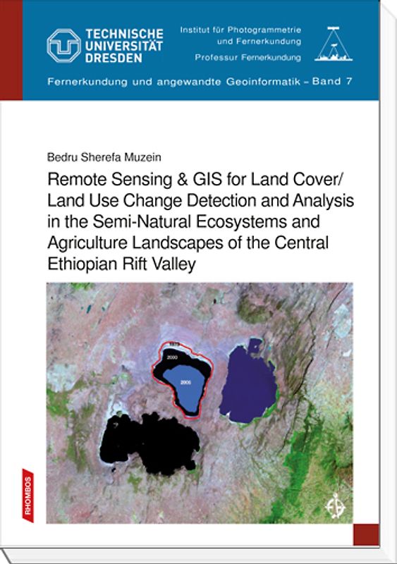
Remote Sensing & GIS for Land Cover/Land Use Change Detection and Analysis in the Semi-Natural Ecosystems and Agriculture Landscapes of the Central Ethiopian Rift Valley
Bedru Muzein (Broschiert, Englisch)
★★★★★
☆☆☆☆☆ Keine Bewertungen vorhanden
Optischer Zustand
Beschreibung
Nowadays earth observation satellites continuously acquire huge amounts of data with the effect that the capacity of current technologies to extract and analyse spatial data can hardly cope up properly. This abundance of spatial data is especially in developing countries not adequately used because the setup of spatial data infrastructure is at its infancy.
This research work represents a valuable… step towards the establishment of the relationship of spectral signatures of MODIS satellite imagery and biophysical characteristics of agricultural and semi-natural ecosystems along parts of the Ethiopian Rift Valley. Important issues regarding the assessment of multi-temporal dynamics of the encroachment of protected areas by livestock are systematically investigated by analyzing the monthly animal feed shortage or surplus as detected by MODIS imagery. Easy-to-handle empirical formulae and extended models of respective calculation are provided. The trend of degradation of ecologically important areas is accurately mapped and the annual net loss is calculated.
Experts and stakeholders in natural resources management, in remote sensing and GIS with special regard to assessment of land degradation and sustainable land management as well as policy makers dealing with environment governance and students aspiring to become experts in natural resources management and remote sensing and/or GIS for ecological regional development may find this book useful for enlarging their methodological as well as practical level of knowledge. Dieses Produkt haben wir gerade leider nicht auf Lager.
Handgeprüfte Gebrauchtware
Bis zu 50 % günstiger als neu
Der Umwelt zuliebe
Technische Daten
Erscheinungsdatum
01.09.2010
Sprache
Englisch
EAN
9783941216235
Herausgeber
Rhombos-Verlag
Sonderedition
Nein
Autor
Bedru Muzein
Seitenanzahl
190
Auflage
1
Einbandart
Broschiert
Einbandart Details
Klebebindung
-.-
★★★★★
☆☆☆☆☆ Leider noch keine Bewertungen
Leider noch keine Bewertungen
Sicher bei rebuy kaufen

Schreib die erste Bewertung für dieses Produkt!
Wenn du eine Bewertung für dieses Produkt schreibst, hilfst du allen Kund:innen, die noch überlegen, ob sie das Produkt kaufen wollen. Vielen Dank, dass du mitmachst!
Sicher bei rebuy kaufen