iPhoneAlle anzeigen
iPhone 11iPhone 11 ProiPhone 11 Pro MaxiPhone 12iPhone 12 ProiPhone 12 Pro MaxiPhone 12 miniiPhone 13iPhone 13 ProiPhone 13 Pro MaxiPhone 13 miniiPhone 14iPhone 14 PlusiPhone 14 ProiPhone 14 Pro MaxiPhone 15iPhone 15 PlusiPhone 15 ProiPhone 15 Pro MaxiPhone 16iPhone 16 PlusiPhone 16 ProiPhone 16 Pro MaxiPhone 16eiPhone 8iPhone 8 PlusiPhone SE 2020iPhone SE 2022iPhone XiPhone XRiPhone XSiPhone XS Max
Galaxy A-SerieAlle anzeigen
Galaxy A12Galaxy A13Galaxy A13 5GGalaxy A14Galaxy A15Galaxy A16Galaxy A17 5GGalaxy A20eGalaxy A21Galaxy A22Galaxy A23Galaxy A24Galaxy A25Galaxy A26 5GGalaxy A32Galaxy A33Galaxy A34Galaxy A35Galaxy A36 5GGalaxy A40Galaxy A41Galaxy A42Galaxy A50Galaxy A51Galaxy A52Galaxy A53Galaxy A54Galaxy A55Galaxy A56 5GGalaxy A70Galaxy A71Galaxy A72
Redmi SeriesAlle anzeigen
Redmi 10Redmi 13CRedmi 15 5GRedmi Note 10Redmi Note 10 ProRedmi Note 11Redmi Note 11 ProRedmi Note 11 Pro Plus 5GRedmi Note 11sRedmi Note 12Redmi Note 12 5GRedmi Note 12 ProRedmi Note 12 Pro 5GRedmi Note 12 Pro PlusRedmi Note 13Redmi Note 13 5GRedmi Note 13 ProRedmi Note 13 Pro PlusRedmi Note 14Redmi Note 14 Pro PlusRedmi Note 8Redmi Note 8 ProRedmi Note 9Redmi Note 9 Pro
- Startseite
Bücher Englische Bücher Wissen & Bildung Naturwissenschaft, Medizin, Informatik, Technik Geowissenschaft Stadt-, Raum- und Landschaftsplanung Integration of Remote Sensing and GIS in Studying Vegetation Trends and Conditions in the Gum Arabic Belt in North Kordofan, Sudan
Derzeit nicht verfügbar
Handgeprüfte Gebrauchtware
Bis zu 50 % günstiger als neu
Der Umwelt zuliebe
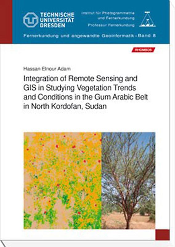
Integration of Remote Sensing and GIS in Studying Vegetation Trends and Conditions in the Gum Arabic Belt in North Kordofan, Sudan
Hassan Elnour Adam (Broschiert, Englisch)
★★★★★
☆☆☆☆☆ Keine Bewertungen vorhanden
Optischer Zustand
Beschreibung
Hassan Elnour Adam
Integration of Remote Sensing and GIS in Studying Vegetation Trends and Conditions in the Gum Arabic Belt in North Kordofan, Sudan
158 Seiten. Format: B5. Broschur. Sprache: Englisch.
Preis: 28,00 Euro.
ISBN 978-3-941216-58-7
RHOMBOS-VERLAG, Berlin 2011.
Band 8 der Reihe „Fernerkundung und angewandte Geoinformatik“. Herausgegeben von Univ. Prof. Dr. habil. Elmar Csaplovics,… Lehrstuhl Remote Sensing, FR Geowissenschaften, TU Dresden
The gum arabic belt in Sudan plays a significant role in environmental, social and economical aspects. The belt has suffered from deforestation and degradation due to natural hazards and human activities. Data bases of land cover and vegetation can be used to develop maps of habitat suitability (digital vegetation map) including information on forest cover and canopy structure. Remote sensing offers a quick and efficient approach to the classification and mapping of land use land cover in a basis for future planning. This study used remotely sensed imagery to identify and delineate various land use land cover categories and types of vegetation cover present in the gum arabic belt in Kordofan region using recent methodologies of classification such as sub-pixel approach using object-based approach. Also, the integration of terrestrial forest inventory and remotely sensed data for the estimation of forest stand parameters of Acacia senegal trees was tested. The study integrated data from different sources and used different methods and approaches to analyse the long term land use land cover changes and trends during the previous three decades in the gum arabic belt in Kordofan State. The approach includes imageries from different satellites (Landsat and TERRA) for multi-temporal dates and integrated to fieldwork (forest inventory).
A vegetation maps are derived as an approach for vegetation evaluation, which is required for the effective management of natural resources in Kordofan region. The land cover modifications in condition and composition of vegetation cover as important aspects of change are considered in current research, as well as providing forest managers with more current and improved data for the purposes of forest inventory. The research contributes to the fundamental concerns of resources management including forestry and land use with developed approaches and methodologies using remote sensing and GIS and providing useful information for specific purposes. Dieses Produkt haben wir gerade leider nicht auf Lager.
Handgeprüfte Gebrauchtware
Bis zu 50 % günstiger als neu
Der Umwelt zuliebe
Technische Daten
Erscheinungsdatum
01.05.2011
Sprache
Englisch
EAN
9783941216587
Herausgeber
Rhombos-Verlag
Sonderedition
Nein
Autor
Hassan Elnour Adam
Seitenanzahl
158
Einbandart
Broschiert
Autorenporträt
The author
Hassan Elnour Adam was born in 1970 in Elobeid, Sudan. He graduated from Faculty of Forestry, University of Khartoum with B.Sc. (Hons.). He has been working as a teaching assistant since 1995 in the Forestry and Range Sciences Department, University of Kordofan. In 2000 he obtained his MSc. (Tropical Forestry) at the Technology University of Dresden, where he also completed his PhD degree (2011) at the Institute of Photogrammetry and Remote Sensing. Currently he is working as assistant professor at University of Kordofan, Sudan. Mr. Adam E. Hassan is an expert in the area of application of remote sensing and GIS in sustainable forest management and land use land cover analysis. He presented his research in many international conferences. Also he enrolled in supervision of MSc. students, lecturing and teaching of practical courses in the field of remote sensing and applied geoinformation analysis. Mr. Adam E. Hassan is able to accomplish a broad spectrum of tasks related to the fields of his study.
Schlagwörter
Remote Sensing, Raumplanung, Vegetation
Thema-Inhalt
RP - Raumplanung
Höhe
240 mm
Breite
17 cm
-.-
★★★★★
☆☆☆☆☆ Leider noch keine Bewertungen
Leider noch keine Bewertungen
Sicher bei rebuy kaufen

Schreib die erste Bewertung für dieses Produkt!
Wenn du eine Bewertung für dieses Produkt schreibst, hilfst du allen Kund:innen, die noch überlegen, ob sie das Produkt kaufen wollen. Vielen Dank, dass du mitmachst!
Sicher bei rebuy kaufen