iPhoneAlle anzeigen
iPhone 11iPhone 11 ProiPhone 11 Pro MaxiPhone 12iPhone 12 ProiPhone 12 Pro MaxiPhone 12 miniiPhone 13iPhone 13 ProiPhone 13 Pro MaxiPhone 13 miniiPhone 14iPhone 14 PlusiPhone 14 ProiPhone 14 Pro MaxiPhone 15iPhone 15 PlusiPhone 15 ProiPhone 15 Pro MaxiPhone 16iPhone 16 PlusiPhone 16 ProiPhone 16 Pro MaxiPhone 16eiPhone 8iPhone 8 PlusiPhone SE 2020iPhone SE 2022iPhone XiPhone XRiPhone XSiPhone XS Max
Galaxy A-SerieAlle anzeigen
Galaxy A12Galaxy A13Galaxy A13 5GGalaxy A14Galaxy A15Galaxy A16Galaxy A17 5GGalaxy A20eGalaxy A21Galaxy A22Galaxy A23Galaxy A24Galaxy A25Galaxy A26 5GGalaxy A32Galaxy A33Galaxy A34Galaxy A35Galaxy A36 5GGalaxy A40Galaxy A41Galaxy A42Galaxy A50Galaxy A51Galaxy A52Galaxy A53Galaxy A54Galaxy A55Galaxy A56 5GGalaxy A70Galaxy A71Galaxy A72
Redmi SeriesAlle anzeigen
Redmi 10Redmi 13CRedmi 15 5GRedmi Note 10Redmi Note 10 ProRedmi Note 11Redmi Note 11 ProRedmi Note 11 Pro Plus 5GRedmi Note 11sRedmi Note 12Redmi Note 12 5GRedmi Note 12 ProRedmi Note 12 Pro 5GRedmi Note 12 Pro PlusRedmi Note 13Redmi Note 13 5GRedmi Note 13 ProRedmi Note 13 Pro PlusRedmi Note 14Redmi Note 14 Pro PlusRedmi Note 8Redmi Note 8 ProRedmi Note 9Redmi Note 9 Pro
- Startseite
Bücher Wissen & Bildung Naturwissenschaft, Medizin, Informatik, Technik Geowissenschaft Geografie Successful Response Starts with a Map
Derzeit nicht verfügbar
Handgeprüfte Gebrauchtware
Bis zu 50 % günstiger als neu
Der Umwelt zuliebe
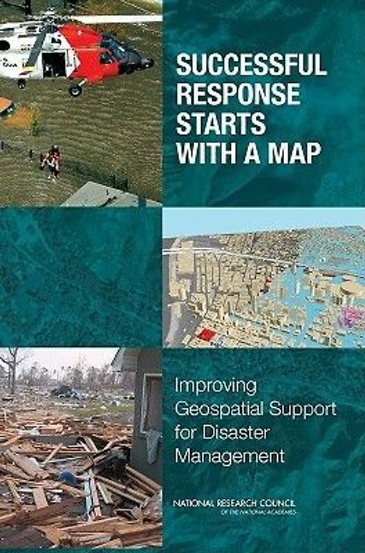
Successful Response Starts with a Map
Mapping Science Committee, National Research Council, Division On Earth And Life Studies, Board On Earth Sciences And Resources, Committee on Planning for Catastrophe a Blueprint for Improving Geospatial Data Tools and Infrastructure (Broschiert, Englisch)
★★★★★
☆☆☆☆☆ Keine Bewertungen vorhanden
Optischer Zustand
Beschreibung
In the past few years the United States has experienced a series of disasters, such as Hurricane Katrina in 2005, which have severely taxed and in many cases overwhelmed responding agencies. In all aspects of emergency management, geospatial data and tools have the potential to help save lives, limit damage, and reduce the costs of dealing with emergencies. Great strides have been made in the past… four decades in the development of geospatial data and tools that describe locations of objects on the Earth's surface and make it possible for anyone with access to the Internet to witness the magnitude of a disaster. However, the effectiveness of any technology is as much about the human systems in which it is embedded as about the technology itself. Successful Response Starts with a Map assesses the status of the use of geospatial data, tools, and infrastructure in disaster management, and recommends ways to increase and improve their use. This book explores emergency planning and response; how geospatial data and tools are currently being used in this field; the current policies that govern their use; various issues related to data accessibility and security; training; and funding. Successful Response Starts with a Map recommends significant investments be made in training of personnel, coordination among agencies, sharing of data and tools, planning and preparedness, and the tools themselves. Dieses Produkt haben wir gerade leider nicht auf Lager.
Handgeprüfte Gebrauchtware
Bis zu 50 % günstiger als neu
Der Umwelt zuliebe
Technische Daten
Erscheinungsdatum
06.08.2025
Sprache
Englisch
EAN
9780309103404
Autor
Mapping Science Committee, National Research Council, Division On Earth And Life Studies, Board On Earth Sciences And Resources, Committee on Planning for Catastrophe a Blueprint for Improving Geospatial Data Tools and Infrastructure
Einbandart
Broschiert
Einbandart Details
Trade Paperback (US)
Höhe
226 mm
Breite
152 mm
-.-
★★★★★
☆☆☆☆☆ Leider noch keine Bewertungen
Leider noch keine Bewertungen
Sicher bei rebuy kaufen

Schreib die erste Bewertung für dieses Produkt!
Wenn du eine Bewertung für dieses Produkt schreibst, hilfst du allen Kund:innen, die noch überlegen, ob sie das Produkt kaufen wollen. Vielen Dank, dass du mitmachst!
Sicher bei rebuy kaufen